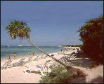
Isla de La Juventud Geography
Special municipality, the largest in Cuba, contained in an island located in the Golfo de Batabanó, south from the western portion of the island of Cuba. The isle has an extension of 2 419 sq km (934 sq mi) and a population of 77 076 inhabitants (1996).
Its territory is mainly plain, divided in two sections by the Lanier marshlands. The first section, the north plain, comprises the hills of Sierra de Casas, having a maximum height of 261 m (856 ft) and those of Sierra de Caballos, 303 m (994 ft). The second section, the south plain, has a carsic origin.
 Its hydrographic network has a radial configuration and is represented by rivers Las Nuevas, San Pedro, Las Casas, and Júcaro. There is an abundant vegetation of semi-deciduous woods.
In the region, there is a development of cattle raising and agriculture, particularly citrics, which are an exportable resource.