Las Tunas Geography
Westernmost province in Cuba’s eastern region limiting north with Camagüey and the Atlantic Ocean; to the east with Holguín; to the south with Granma and the gulf of Guacanayabo; and to the west with Camagüey.
It has an extension of 6 587,8 sq km (2544 sq mi) and an estimated population of 516 795 inhabitants (1996). It ranks ninth in extension and tenth in population.

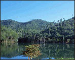
Its landscape is characterized by plains. Among them are worth-mentioning the northern Camagüey-Las Tunas plain, where the hills of Caisimú, with a maximum height of 122 m (400 ft) and Dumañuecos, with a maximum height of 129 m (423 ft) are located; the central Camagüey-Las Tunas plain towards the central zone, where we find elevations like Cerro Verde, with a maximum height of 188 m (617 ft) and the Jenjibre hill, with a maximum height of 140 m (459 ft); the southern Camagüey-Las Tunas plain towards the southwest; and towards the southeast the Cauto plain, low zone with some swampy areas.
The region counts on China-clay ore and salt deposits. Its most important rivers are Chaparra, Jobabo, Sevilla, and Tana.
Its economy is characterized by a predominance of sugarcane industry, as well as mining and siderurgical industry.


