Matanzas Geography
Province located in the western region of Cuba. It has an extension of 11 802,5 sq km (4557 sq mi) and an estimated population of 639 257 inhabitants (1996). The province ranks second in extension and ninth in population. The province is divided into 14 municipalities and its capital city is Matanzas.
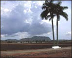
Plains ocupy 80% of the territory and there are some heights towards the northwest and center west of the province which coincide with the Habana-Matanzas heights, being the highest point the Pan de Matanzas with 381 m (1250 ft), and the Bejucal-Madruga-Coliseo heights, with the hill of El Jacán (316 m, 1036 ft) as highest altitude. To the south we find the Zapata plain, a low and swampy zone having peculiar characteristics. Matanzas possesses huge reserves of groundwater and rivers like Hanábana, Canímar, and Yumurí. It has also important bays like those of Cárdenas and Matanzas, the latter being one of the most active ports of the country.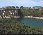
Its extremely fertile and productive soil is mostly devoted to agricultural production. The main crops are sugarcane, citrics, rice, grains, and vegetables. It is grown also the sisal from which skin textile fibers are extracted.